Today we are happy to share the launch of the Scientific Roadmap for Advancing Agricultural Nitrous Oxide MMRV and Modeling, the product of a yearlong collaboration among more than two dozen U.S. and Canada-based scientific experts.
Taylor Geospatial was honored to help guide this effort alongside colleagues at the Natural Resources Defense Council, bringing together researchers from universities, federal agencies, industry, and the nonprofit sector to reach consensus on the research needed to develop fit-for-purpose tools and methods to measure, model, and ultimately reduce the nitrous oxide emissions that come from the ways we grow our food. Agriculture and food security are a priority application area for Taylor Geospatial, and convening this roadmap is part of a longer-term commitment to putting the power of geospatial science into the hands of the communities and practitioners who depend on it.
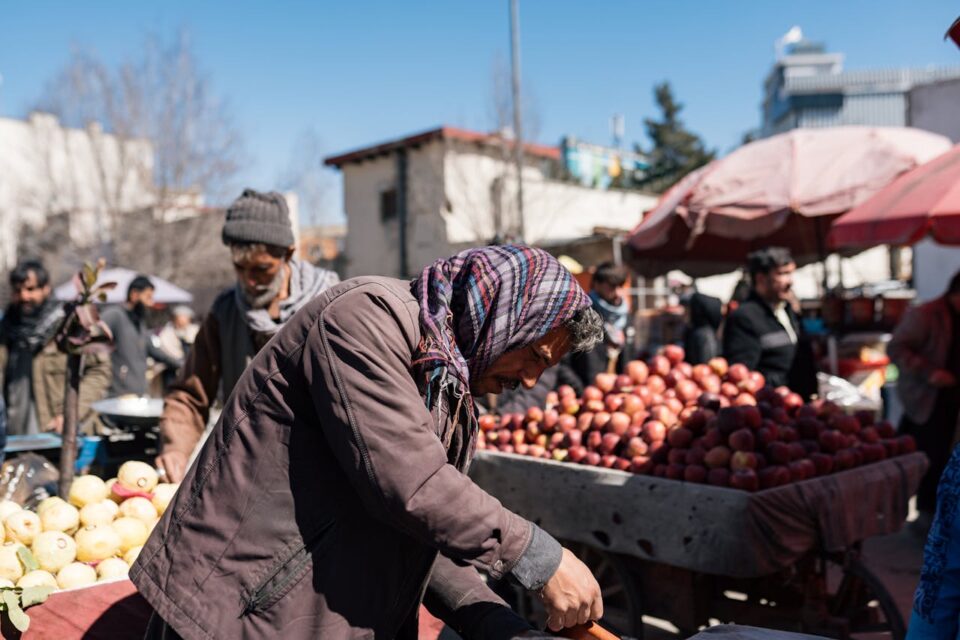
The roadmap plainly makes the case for why this work is necessary. Nitrous oxide (N₂O) is a greenhouse gas with roughly 273 times the warming power of carbon dioxide over a century. It is the dominant driver of stratospheric ozone depletion. Agriculture is responsible for about 80 percent of anthropogenic N₂O emissions, and those emissions also impose large, quantifiable public costs across drinking-water contamination, ecosystem damage, and elevated cancer risk. Taken together, these impacts are estimated to cost Americans as much as $210 billion a year.
Yet our ability to measure agricultural N₂O at the specificity needed to guide farm practices, inform policy, verify markets, and back corporate climate claims is strikingly limited. Only seventeen long-term N₂O measurement sites operate across the entire United States, and some national inventories still rely on DayCent calibrations from just seventy-five observation points. A shared, prioritized agenda is essential to rapidly growing our collective capacity to assess N₂O emissions and enable their mitigation.
The role of geospatial innovation in this work
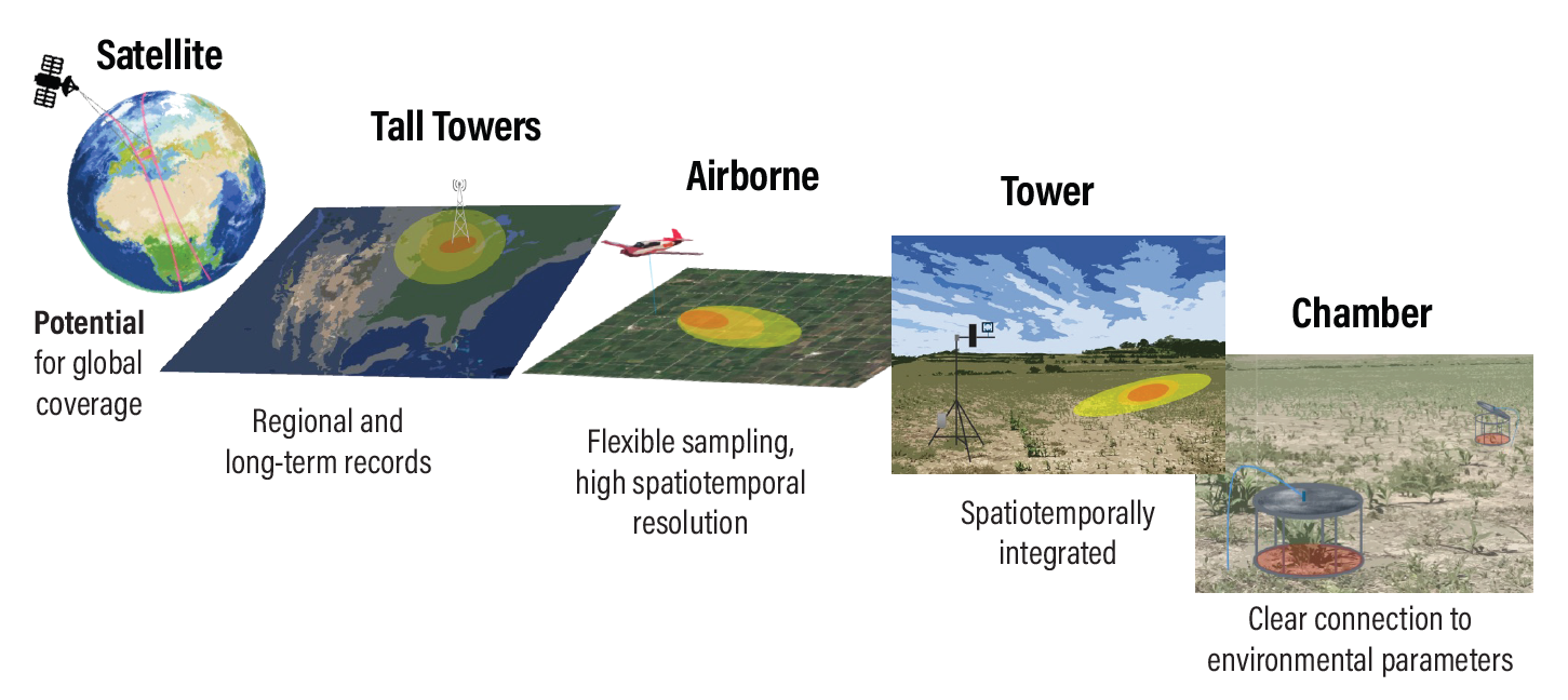
Nearly every problem identified in this roadmap is, at its core, a geospatial problem. N₂O emissions are famously heterogeneous in space and time. Roughly one percent of the “hottest moments” in a year contribute nearly half of total annual N₂O losses, and poorly drained soils can emit at twice the rate of their better-drained neighbors.
Quantifying that variability means integrating observations that live at fundamentally different scales: from chamber measurements across a few square meters to eddy-covariance towers across hectares to aircraft campaigns across tens to hundreds of kilometers. Ideally satellites with global reach will become part of the measurement cadre, too. Connecting those scales, fusing them with land-cover and land-management data layers, and delivering the results into models and decisions is exactly the kind of work geospatial science exists to do.
Taylor Geospatial’s role as a convener is a reflection of where we believe progress happens: at the intersection of foundational geospatial innovation and advances in the disciplines that put it to use. We are committed to co-developing tools and methods with the practitioners and end users who will ultimately put them to work: farmers, agronomists, sustainability teams, atmospheric scientists, data stewards, and policymakers. Agricultural N₂O MMRV sits squarely at that intersection, and the roadmap is a blueprint for the kind of application-grounded, community-shaped research Taylor Geospatial exists to accelerate.
GeoAI and the future of N₂O MMRV and modeling
Developing and applying emergent GeoAI technologies is core to Taylor Geospatial’s mission to accelerate the integration of geospatial innovations into applications like agricultural management and emissions monitoring.
The development and adoption of GeoAI methods are necessary to make progress on several of the research priorities identified in the roadmap. For example, the roadmap’s authors highlighted combining process-based models with machine learning as key to improving model quality, pointing to knowledge-guided architectures such as KGML-ag as particularly promising.
Process-based models like DNDC and DayCent encode decades of mechanistic understanding of how soils, microbes, weather, and management practices generate N₂O. Machine-learning models, by contrast, are powerful at finding nonlinear patterns across multi-scale observational datasets but can be opaque and data-hungry. Hybrid approaches–physically informed, interpretable, and less dependent on massive training sets–are a promising route.
In addition to improved models, Taylor Geospatial’s focus on GeoAI strongly aligns with the following recommendations from the roadmap:
- Satellite retrieval algorithms that account for atmospheric variability,
- AI tools that operate on structured semantic relationships,
- Proxy-based inference from co-occurring species like NO₂, and
- On-sensor firmware that delivers real-time, machine-learning-enabled decision support.
A credible national N₂O MMRV system would be, in effect, a large-scale demonstration of what GeoAI can do when it is co-developed with the people who plan to use it.
Open science and cross-scale coordination
If there is a single thread that runs through the roadmap, it is the conviction that open science is required to make progress on agricultural N₂O. Emissions vary across plots, fields, landscapes, watersheds, and regions, and no individual lab, agency, or company can cover that range alone.
The roadmap therefore places heavy emphasis on the shared infrastructure that makes cross-scale collaboration possible:
- Coordinated multi-site monitoring networks,
- Benchmark datasets that are FAIR (findable, accessible, interoperable, and reusable),
- Community-maintained semantic resources and ontologies,
- Open-source sensor firmware and model code,
- Standardized methodological descriptions, and
- Data-governance frameworks that protect farmer privacy while enabling integration.
Without these foundations, chamber-scale measurements cannot be reliably combined with tower, aircraft, and future satellite observations; machine-learning methods cannot be trained and validated on representative data; and models cannot be compared or improved across the regions and cropping systems that matter.
Open science and cross-scale data coordination are central to Taylor Geospatial’s own research priorities. We see them as prerequisites for application-grounded geospatial research: only when data, methods, and models flow openly between researchers and the practitioner communities who use them can science translate reliably into on-the-ground impact. The roadmap’s framing of N₂O MMRV as shared, pre-competitive infrastructure, the foundation on which both public policy and private markets depend, is precisely where we believe geospatial can add the most value.
Applied research for the public benefit
Taylor Geospatial exists to produce geospatial research that benefits the public, and the N₂O roadmap is a clear example of what that looks like in practice. The roadmap’s intended audience is not narrowly academic. It is written to build momentum for applied research initiatives with end users and to ground policy in science. Ultimately we hope this roadmap will support the work of farmers making on-farm nitrogen decisions, NGOs designing supply-shed programs, companies trying to meet Scope 3 commitments without misreporting, regulators implementing the 2026 U.S. and EU climate disclosures, and funders deciding where new dollars will have the greatest leverage.
It makes the public-benefit case explicitly: improved MMRV lowers farmer input costs, reduces public remediation costs, protects drinking water, strengthens the credibility of climate markets, and ensures that public investments in nitrogen management can actually be evaluated against measurable outcomes.
This co-development posture–research that is shaped by and delivered back to the communities it is meant to serve–is how Taylor Geospatial approaches applied research across all of our priority areas, including agriculture and food security, humanitarian and disaster relief, defense and security, and regional natural resource management.
Fostering St. Louis as a hub of geospatial expertise
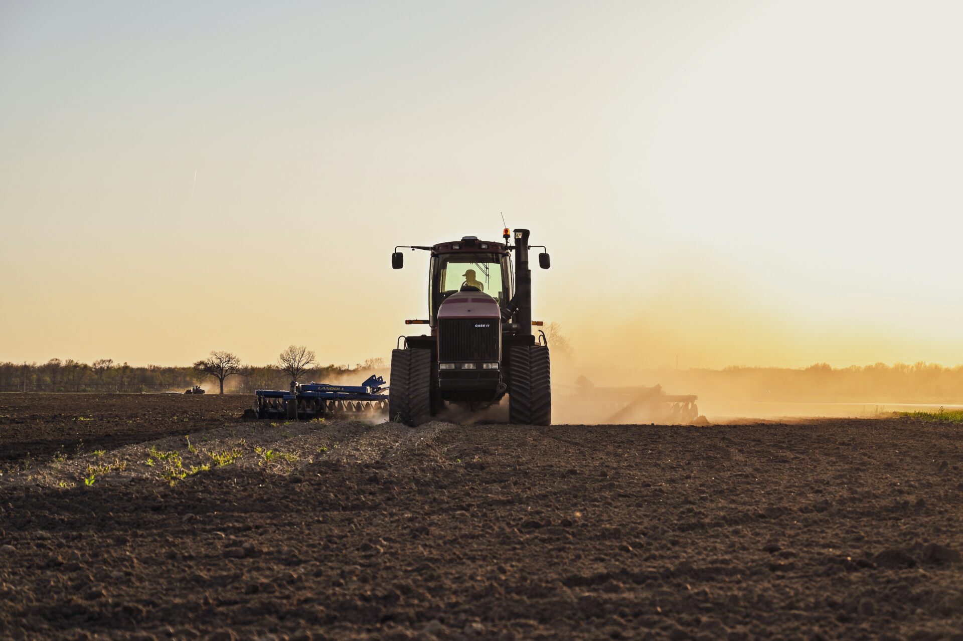
St. Louis sits at a unique intersection for a project like this one. It is the gateway to the Corn Belt, the region that dominates U.S. agricultural N₂O emissions and whose corn-soybean rotations on poorly drained soils figure prominently in the roadmap. It is home to a remarkable concentration of agricultural-technology companies, plant-science institutions, geospatial firms, and federal partners. It’s also home to a growing research community with the breadth needed to tackle problems that cross soil science, remote sensing, atmospheric modeling, AI, and decision support.
Helping convene this roadmap is part of how Taylor Geospatial is growing that hub. Ongoing engagement with this research agenda brings leading N₂O researchers into contact with St. Louis-based expertise in GeoAI, satellite data infrastructure, and agricultural innovation. It gives local companies, growers, and agencies a direct line into a national research agenda whose priorities–including cheaper sensors, multi-scale monitoring networks, hybrid models, and FAIR data pipeline–align closely with capabilities the St. Louis ecosystem is building and with the practitioner communities it serves.
What comes next
The roadmap identifies thirty-seven high-value research opportunities and distills them into ten community-consensus priorities that it emphasizes as the near-term focus for the field. Those ten priorities span cheaper and more portable sensors, new measurement modalities, coordinated multi-site networks, rigorous QA/QC, methods that connect measurements across scales, FAIR data practices, sustained data infrastructure, faster pipelines from observations into models, regular model intercomparison, and the integration of process-based models with machine learning.
Open science, cross-scale coordination, and sustained co-development with practitioner communities are central to driving the uptake of this agenda. Taylor Geospatial intends to keep playing a connective role to help turn the roadmap’s recommendations into reality. We are grateful to the authors, to our partners at NRDC, and to every researcher who contributed time and expertise to this community-built document. The work of turning its priorities into deployed sensors, calibrated models, and usable decision tools is just beginning, and we look forward to being part of what comes next.
Rachel Opitz served as a co-convener of the roadmap on behalf of Taylor Geospatial, alongside Daniel Rath and Matthew Kaplan of NRDC.