ST. LOUIS – Registration is now open for Geo-Resolution 2024, the annual event that brings together the geospatial community in the St. Louis region and beyond. The day-long conference, which is cosponsored by the National Geospatial-Intelligence Agency and Saint...
Core Geospatial Science
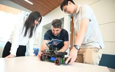
TGI Spotlight: Rethinking Multimodal Localization
By Bob Grant Localization, precisely pinpointing the position of a person, autonomous vehicle, or anything else on planet Earth, is one of the holy grails of geospatial technology. There are various localization methods, including GPS, beacon-based localization,...
TGI Announces New LinkedIn Group: The TGI Research and Technology Hub
by Bob Grant During the week of February 26th, TGI announced a new LinkedIn Group to help researchers, administrators, and others share award opportunities, requests for proposals, emerging geospatial technologies, interesting new publications, and more using the...
A Geospatial Journey Marked by Courage: Nadine Alameh’s Story
by Bob Grant Nadine Alameh is the inaugural executive director of the Taylor Geospatial Institute (TGI). Here, she reflects on key moments from her life that brought her to this new position and made her a world-renowned geospatial expert. Nadine Alameh, Ph.D., was a...
Dispatch from the TGI Consortium: Fred: A Goose on a Mission
by Bob Grant, Executive Director of Communications, Research It’s not every day that you ride your bicycle up to Saint Louis University President Fred P. Pestello, Ph.D. and ask if it would be OK to name woodland creatures after him. That kind of incident has a much...
Dispatch from the TGI Consortium: Interactive approach to geospatial search combines aerial imagery, reinforcement learning
by Shawn Ballard, Washington University in St. Louis Communications Specialist When combatting complex problems like illegal poaching and human trafficking, efficient yet broad geospatial search tools can provide critical assistance in finding and stopping the...
Dispatch from the TGI Consortium: Missouri S&T Researcher Works to Improve Geospatial Analytics
by Greg Edwards, Senior Strategic Communications Consultant at Missouri University of Science and Technology Imagine owning a library with every book imaginable—millions and millions of titles—but not having a way to organize the different texts or search for specific...
Saint Louis University, Taylor Geospatial Institute Ramp Up Hiring of Geospatial Faculty
By Maggie Rotermund ST. LOUIS — Saint Louis University will hire 20 new faculty members in core geospatial science and related fields in an ambitious cluster hiring initiative. The new positions, which will be filled over a three-year span, will be hired in...
A Geospatial Welcome
By Nadine Alameh I’ll start this message the same way I would likely start and end all my communications with the amazing consortium that is the Taylor Geospatial Institute—with a thank you! Thank you for your warm welcome, thank you for your commitment to TGI’s...
Taylor Geospatial Career Guide Series Kicks Off with an Impassioned Presentation of the Potential of Geospatial Science from TGI Executive Director Nadine Alameh
by Bob Grant ST. LOUIS — The Taylor Geospatial Institute launched its Geospatial Career Guide Series by welcoming students, professionals, and anyone else interested in exploring geospatial careers to listen and engage in the first installment on September 14, 2023....
Saint Louis University Receives $1 Million NGA Grant to Establish Midwestern Satellite Calibration Network
by Maggie Rotermund ST. LOUIS — Earthquake fault lines. Abandoned mines. Transportation infrastructure. Dams and Levees. Location of Goods and Supplies. Government agencies, researchers and public entities rely on geospatial technology to locate existing geographic...
SLU, NGA Host AI-Focused Geo-Resolution Conference on September 28
by Maggie Rotermund ST. LOUIS, MO – The National Geospatial-Intelligence Agency and Saint Louis University will co-host the Geo-Resolution 2023 conference, “Digital Transformations: Navigating a World of Data from Seabed to Space,” Thursday, Sept. 28, at SLU’s Busch...


