 Geospatial Innovation for Food Security
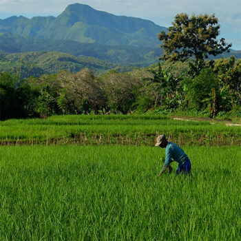
 Fields of The World
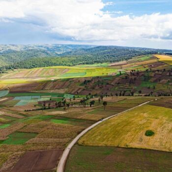
 Features of The World
 Benchmarks of The World
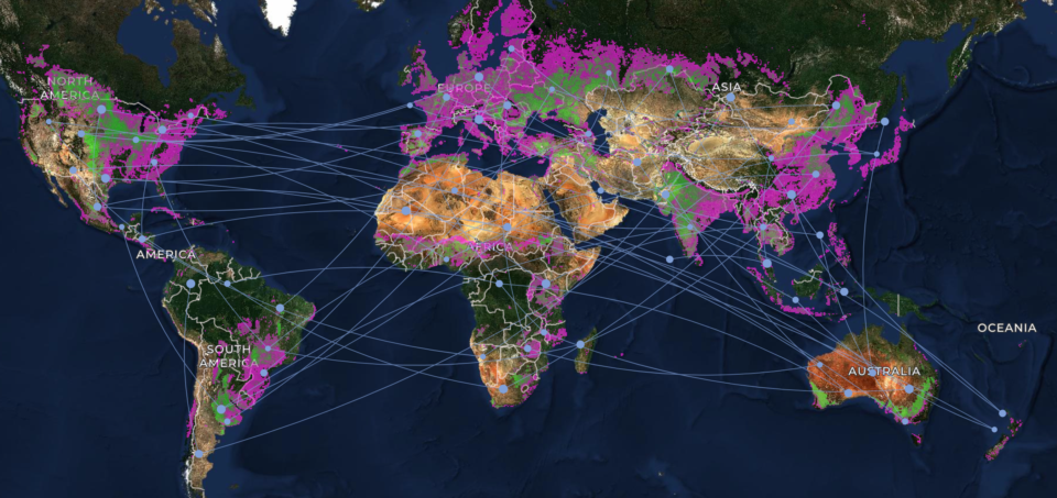
In April 2026, Taylor Geospatial released something that had never existed before: a map of agricultural field boundaries covering the entire globe, generated at 10-meter resolution derived using geoAI on Sentinel-2. It was the product of a collaboration among academic labs at Arizona State University, Washington University in St. Louis, and Clark University; infrastructure partner Wherobots; co-investor Microsoft AI for Good Lab; and an ecosystem of Technical Fellows who helped turn research into commonly usable tech. From the beginning, that circle also included practitioners and organizations who’d eventually put the data to work.
You can read the full story in our original announcement. For more on how it came together, hear from Jennifer Marcus, VP for Strategic Innovation Programs, and Isaac Corley, Director of AI/ML Research, on the Spatial Stack podcast with Matt Forrest and the Satellite Image Deep Learning podcast with Robin Cole.
Here, we want to focus on what comes next, and on the role we’re inviting you to play in it.
User Input Has Shaped This Work From the Beginning
Fields of The World has always been a collaborative effort. Since it began in February 2024, one of the founding principles has been to bring potential users directly into the planning process. That commitment took shape early: by November 2024, a workshop and public showcase at Washington University in St. Louis brought together stakeholders including the World Resources Institute, Bayer, Planet, and Varda, each helping align the collaboration with industry needs. In March 2025, that group expanded to include the UN FAO and ag-tech partners such as Regrow, Cecil, AgGateway, and INTENT.
Between these in-person workshops, held roughly twice a year, the community has stayed connected through weekly working meetings open to contributors and stakeholders alike.
We are establishing a User Advisory Group to build on this foundation. It gives that ongoing collaboration a more permanent structure as the initiative continues to grow and reach new users worldwide.
Global Datasets and Global Challenges
Training a model for global inference requires an ecosystem of ground truth data, satellite imagery, tools, models, model weights, workflows and post processing. The FTW researchers evaluated optimal approaches for training data, and then moved to evaluating optimal approaches for models and model weights, both with the goal to run inference across the entire globe. We released the first global dataset with the expectation that engagement and feedback from global stakeholders and beneficiaries would guide the next research focus areas.
Collecting Feedback
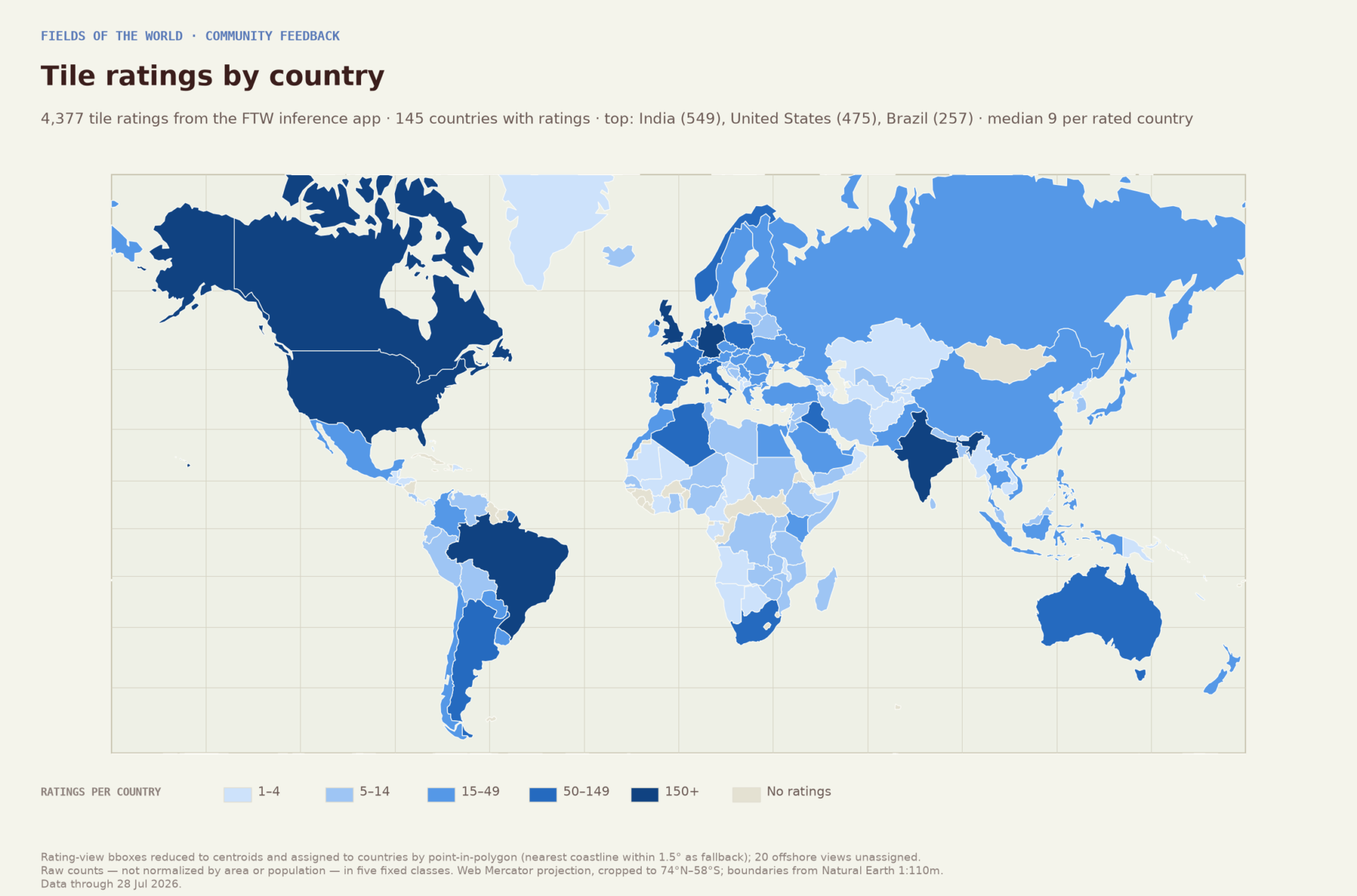
We provided many mechanisms for the community to engage on the outputs of our FTW efforts. A web app includes the opportunity to view data, see confidence ratings, and rate data quality. Simple forms allow viewers to provide more detailed feedback, along with opportunities to participate as an annotator, contributor, and advisor.
Between in-app ratings, direct outreach, and organic commentary on social media, we heard from a wide range of researchers, practitioners, and members of the public.
In addition to gathering feedback from the web app, many stakeholders have reached out to us directly, offering valuable, context-driven insights, contributing potential new data sources, identifying areas for improvement, and helping us to look down the road at the potential impact of this work. These conversations are exactly what we hoped for: a community of scientists, data providers, stakeholders, and end users collectively building upon impactful open-source technology and data. This type of engagement is the key to ensuring the work that we do is useful.
Introducing the FTW User Advisory Group
Building on the collaborative approach we’ve used since 2024, the Fields of The World User Advisory Group formalizes a standing body of practitioners who are willing to help ensure this initiative has an impact. Modeled on human-centered design principles, the group will emphasize real-world application, iterative improvement, and diverse perspectives from organizations that rely on geospatial data to make decisions.
Advisors will:
- Validate the usability of FTW products for particular use cases
- Pilot new datasets and tools before public release
- Provide structured feedback on dataset quality, documentation, usability, and roadmap priorities
- Surface barriers to adoption across different sectors and geographies
- Act as ambassadors, sharing lessons learned within their own communities
We’re looking for 10–15 advisors spanning government agencies, UN organizations, nonprofit and humanitarian groups, academic institutions, and commercial geospatial companies. Their expertise will range from agriculture and food security to data science, machine learning, and geospatial technologies. Preference will go to practitioners who work hands-on with geospatial data day to day so that feedback reflects real operational challenges and workflows.
The role is a 12-month term with four virtual sessions a year, along with periodic written input between sessions and the opportunity to pilot FTW data directly in your own work. In exchange, advisors get early access to new datasets and tools, direct influence over roadmap decisions, a multidisciplinary peer network, and opportunities to co-author publications or case studies.
Applications are open through August 14. We’ll follow up with everyone who applies, selected or not, by the end of August, with a kickoff meeting planned for September.
Other Ways to Get Involved
The Advisory Group is not the only way to contribute. If you’re not an end user of the data but still want to be involved:
- Tell us about your use case. If you’re working with the data or thinking about it, share your use case with us — it helps us understand who’s using FTW and how.
- Contribute code or data. FTW is open source — find the project on GitHub.
- Join the Technical Community Meetings. Sign up through our Google Group for invitations to regular community calls.
- Watch for our Slack community, currently in development, for more informal, day-to-day discussion.
Fields of The World has grown through sustained collaboration with the people who rely on it. The User Advisory Group ensures that collaboration continues, deliberately and at scale, as this work enters its next phase.