Taylor Geospatial Institute
  • ABOUT
    • Vision, Mission & Approach
    • PEOPLE
      • Leadership
      • Governing Council
      • Research Council
      • TGI Fellows
      • TGI Associates
      • TGI Postdoctoral Fellows
  • RESEARCH
    • RESEARCH COLLABORATIVE
      • Institutions
      • Partnerships
    • What Is Geospatial?
    • Core Geospatial Science
    • The Geospatial Frontier
    • Food Systems
    • Geospatial Health
    • National Security
  • CONSORTIUM OPPORTUNITIES
    & SERVICES
  • NEWS & EVENTS
    • News
    • Events
Nadia Shakoor Wants to Change the Face of Farming with Drones

Nadia Shakoor Wants to Change the Face of Farming with Drones

by TaylorGeoAdmin | Nov 16, 2020 | Core Geospatial Science, News, Danforth Center

Several years ago, Nadia Shakoor went looking for something that didn’t exist. As a breeding and genetics researcher at the Donald Danforth Plant Science Center, Shakoor was measuring how crops grew under specific conditions. She sent students with clipboards...
Research Links Sinking Land to Regions of High Groundwater Demand

Research Links Sinking Land to Regions of High Groundwater Demand

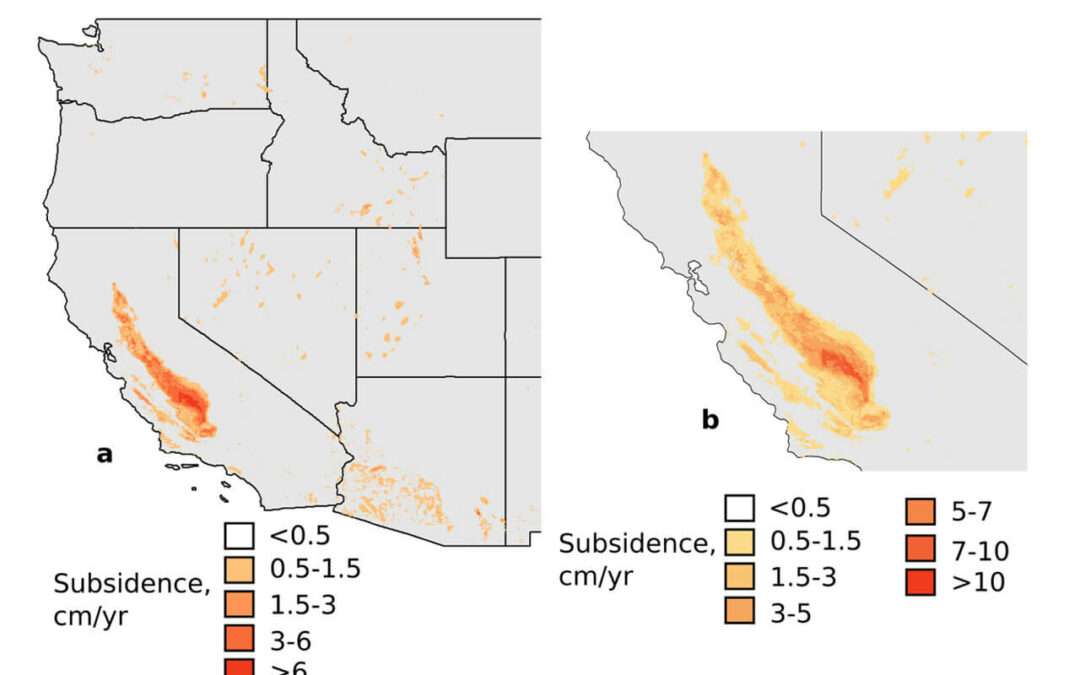
by TaylorGeoAdmin | Sep 24, 2020 | News, Missouri S&T, Core Geospatial Science

Images indicate the estimated rate of land subsidence in areas with high groundwater use in the western U.S. Excessive pumping from underground aquifers can cause the surrounding land to sink and lead to damage to streets, bridges and other infrastructure, reduced...
Harris-Stowe State University, NGA Partner to Train STEM Educators

Harris-Stowe State University, NGA Partner to Train STEM Educators

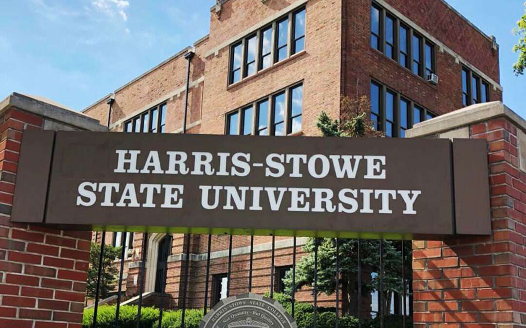
by TaylorGeoAdmin | Sep 21, 2020 | Core Geospatial Science, News, Harris-Stowe State

Harris-Stowe State University and the National Geospatial-Intelligence Agency have teamed up to develop future science, technology, engineering and math (STEM) educators. The local university and government agency announced the partnership Monday, saying in...
Mizzou Engineers, Physicians to Help Rural Missouri Plan Ahead for Pandemic: Geospatial Big Data is Key

Mizzou Engineers, Physicians to Help Rural Missouri Plan Ahead for Pandemic: Geospatial Big Data is Key

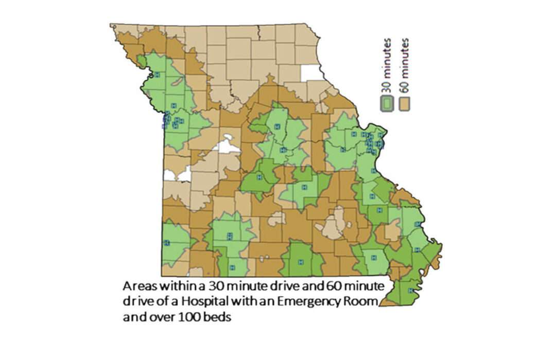
by TaylorGeoAdmin | Jun 22, 2020 | Core Geospatial Science, News, Mizzou

Planning ahead for a pandemic — or any disaster situation — is costly and complex. Now, Mizzou researchers are hoping to take the guesswork out of it for Missouri’s smaller communities. The catalyst for the research is COVID-19. In spite of a months-long...
Next Entries »

Recent Posts

  • Turning Insight Into Action: The Next Wave of GeoAI Innovation is Here
  • Food Systems Have Complicated Problems. Where Can Geospatial Help?
  • What If Becomes What’s Next: Inside the TGI-AWS GeoAI Challenge
  • Unlocking the Power of AI in Geospatial Technology
  • How Geospatial Innovation Can Reduce Food Waste and Improve Access to Nutrition

Recent Comments

No comments to show.
Taylor Geospatial Institute

CONTACT US MEDIA INFO

  • Follow
  • Follow
  • Follow
Copyright 2025 Taylor Geospatial Institute. All Rights Reserved.

Privacy Policy, Terms, and Conditions