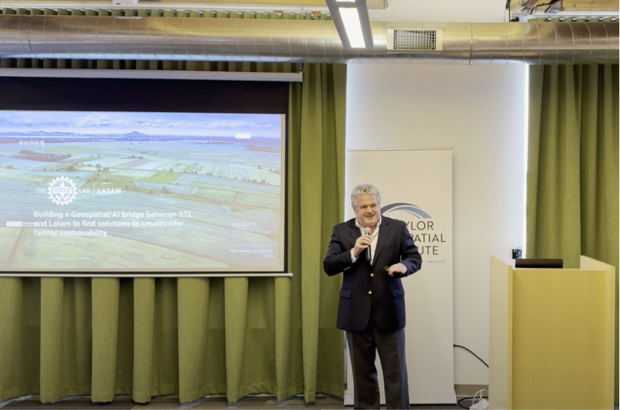
TGI invited Tomás Peña, Managing Director of The Yield Lab LATAM, to share his thoughts on how the push to improve productivity and sustainability in Latin America’s food and agriculture sector creates new opportunities for geospatial innovators. His talk at the Geospatial Innovation for Food Security (GIFS) Challenge kickoff emphasized the need for long-term collaborations between people with diverse perspectives to drive a system-wide change. Watch his presentation and read about some of the main takeaways.
The Takeaways
Opportunities for geospatial in LATAM’s agtech sector are growing, but simplicity of use and integration with workflows remain challenges.
Geospatial tools can help farmers to optimize resources and anticipate risks like pest outbreaks or extreme weather. When combined with AI and machine learning, these tools analyze vast datasets to deliver actionable predictions, enabling farmers to act preventively before challenges escalate.
The Yield Lab LATAM team, co-led by Peña, has made significant strides in connecting farmers with cutting-edge technologies like these. The fund now manages $46 million, focusing on investments in agtech companies that can integrate geospatial data and AI to improve farming practices. “We have 26 investments, many of which are using geospatial data, especially in Brazil,” Peña noted. “These companies are leveraging data from sources like satellites, drones, and even soil sensors. What’s interesting is that farmers often don’t explicitly recognize it as ‘geospatial data’ – they just see it as data that helps them make better decisions.”
Building on this, Peña raised the need for simple, actionable solutions that farmers can easily adopt. Peña explained that farmers seek simplicity over complexity: “They just want tools that help them run their farms more efficiently. The more we can make technology accessible – whether through mobile apps, simple AI tools, or better data integration – the more we can empower farmers to make informed decisions.”
This narrative of moving toward simpler, solution-oriented tools and integration with general-purpose technology workflows may feel familiar to many in the geospatial community. In their infancy, geospatial tools operated as specialized systems, largely in isolation from mainstream IT systems, often with complex interfaces that prioritized functionality over user-friendliness. Think of the myriad tools in early iterations of the ArcGIS toolbox or the dense menus of 1990’s GIS software. As the user base for geospatial software expanded, there was a shift towards more integrated systems and simpler interfaces, inevitably with some trade-offs in functionality.
While technologies like satellite imagery, remote sensing, and AI-driven analytics hold immense potential in agtech, they currently require specialized infrastructure, training, and tooling – barriers that small- and medium-sized farmers in Latin America cannot easily overcome. Increasing integration with mainstream systems, offering simpler, more intuitive interfaces, is again appearing as one path forward, but again with trade-offs.
The challenges of balancing these priorities are reflected in the GIFS Challenge framework as it explores how geospatial data, methods, and technologies can be integrated into farming practices in a way that is accessible, usable, and scalable, while remaining at the forefront of geospatial innovation.
Persistent Innovation-Adoption Gap
In his keynote, Peña focused on the potential for geospatial tools to promote productivity and sustainability in Latin American agriculture. He pointed to how geospatial technologies offer vital solutions by providing real-time insights into critical variables such as crop health, soil quality, water use, and climate conditions. These insights can empower farmers to make better decisions and proactively address varied challenges, paving the way for sustainable agricultural practices.
“There is a huge potential for investment in agtech in Latin America, especially in data-driven solutions. Investment in agtech has skyrocketed in the past five years, but the greatest opportunities lie in harnessing geospatial data”, he said, while adding, “we have the chance to make agriculture more sustainable, more productive, and more profitable if we can effectively connect the right technologies with the right people.”
While the fundamental value of geospatial is widely recognized in agtech circles, Peña argued that the gap between the potential scale of its benefits and its current level of use, especially in LATAM, presents a major opportunity for the geospatial community, but one that requires a real commitment to understanding the region’s dynamics and the day to day work of practitioners. Peña underscored that closing this divide between global innovation hubs and the localized needs of farmers is a critical unmet need. Addressing this will be essential to creating an agricultural ecosystem that harnesses the full potential of technology, data, and investment to drive lasting change.
Sustained Collaboration is Needed
Building strong connections between technological innovators and people working across food and agriculture can help unlock the sector’s adoption of new practices. Peña sees TGI as a valuable partner in building the necessary long-term relationships and trust needed to co-design novel tools and get them into widespread use. Supporting producers as they take up new tools and practices requires engagement beyond the initial technology design phase.
“A major challenge is training farmers and startups to use data effectively. Farmers often struggle to ask the right questions, creating a disconnect between available data and its practical application,” Peña said. The opportunity to share experiences addressing these adoption challenges is one of the ways Peña sees geospatial innovators in agtech benefitting from collaborations through TGI.

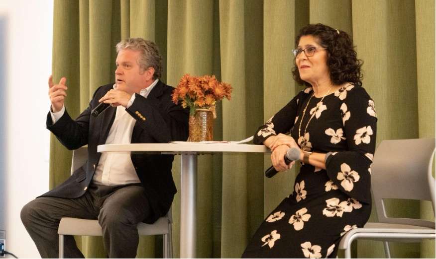
Tomás Peña with TGI Exective Director Dr. Nadine Alameh. Peña believes that collaboration through TGI provides geospatial innovators in agtech a valuable opportunity to share experiences and learn from each other.
“It’s not just about startups and farmers; we need to bring in government, corporates, and educational institutions. For example, we’ve worked with farmers in Colombia and Brazil to integrate new tech into their operations, but we also need to involve banks, insurance companies, and logistics firms. They all play a role in creating an ecosystem where agtech solutions can thrive,” Peña emphasized.
TGI Challenge embraces this same idea of collaboration – it offers a unique space where geospatial technologies and agriculture can intersect in meaningful ways. As Dr. Nadine Alameh, Executive Director of TGI, shared: “At TGI, we prioritize collaboration across sectors and a deep understanding of the problems that geospatial technologies can solve. By bringing together different areas of expertise, we can create more informed, effective solutions to pressing food security issues.”
“Our focus is on ensuring that geospatial technologies are not just innovative but practical and accessible for farmers everywhere,” she added. “By simplifying the application of these tools, we aim to create solutions that empower farmers to make more informed decisions and improve their farming practices sustainably.”
Interested in learning more? Join the GIFS Challenge to collaborate on innovative solutions and help tackle food security challenges globally.
About Taylor Geospatial Institute
TGI is passionate about fueling geospatial science and technology to create the next generation of solutions and policies that the whole world will depend on for sustainability and growth.
The TGI consortium includes Saint Louis University, the Donald Danforth Plant Science Center, Harris-Stowe State University, University of Illinois Urbana-Champaign, Missouri University of Science & Technology, University of Missouri-Columbia, University of Missouri-St. Louis, and Washington University in St. Louis. Collectively, these institutions cover geospatial research from ocean depths to outer space.
For more information, visit taylorgeospatial.org.
