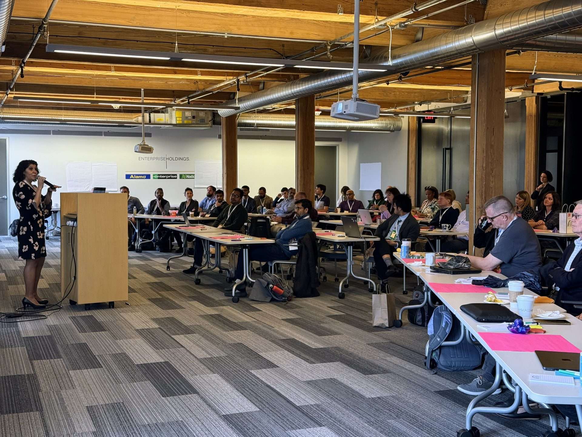
Dr. Nadine Alameh, Executive Director of TGI, addressing the experts at the Geospatial Innovation for Food Security Challenge kick off
TGI is launching the Geospatial Innovation The Geospatial Innovation for Food Security Challenge to bring together experts and practitioners to leverage cutting-edge geospatial technologies to strengthen our global food systems. Learn about collaboration and funding opportunities, and how you can get involved
As the world faces increasing pressure on agricultural systems and natural resources, the challenge of ensuring food security while preserving the planet’s ecosystems has never been more urgent. Addressing this challenge demands bold, innovative action. Geospatial technologies offer data-driven solutions to improve food systems and address critical issues such as waste, inequity, and resource management, transforming the way we produce, distribute, and consume food.
At the forefront of this effort is the Geospatial Innovation for Food Security Challenge, an ambitious initiative launched by the Taylor Geospatial Institute (TGI). The challenge brings together experts in wide-ranging areas – including geospatial science and Artificial Intelligence/Machine Learning, agriculture, and sustainability – to tackle the complex issues impacting global food systems.
Thought for Food: The Vision Behind the Challenge
The Geospatial Innovation for Food Security (GIFS) Challenge is a pioneering initiative that connects researchers developing cutting-edge geospatial technologies with organizations needing to implement them in real-world contexts.
“Our goal is to guide stakeholders through a process that identifies pain points and creates pathways for collaboration, leveraging technological advances to make progress on issues faced across the food system,” said Rachel Opitz, Program Manager, Geospatial Innovation for Food Security, Taylor Geospatial Institute.
Our goal is to guide stakeholders through a process that identifies pain points and creates pathways for collaboration, leveraging technological advances to make progress on issues faced across the food system,

Rachel Opitz, Program Manager, Geospatial Innovation for Food Security, Taylor Geospatial Institute
The initiative unites researchers, innovators, and implementers to develop actionable solutions spanning food production, distribution, and sustainability, to harness geospatial data and technology to reshape our food systems and make them more sustainable and equitable.
Geospatial tools, such as satellite imagery, remote sensing, GIS, and drones equipped with advanced sensors and cameras, optimize the entire food supply chain, from crop production to distribution, while minimizing environmental damage. Satellite imagery helps monitor crop health and climate patterns, GIS maps soil quality, and UAVs provide real-time data on crop conditions, water usage, and pest outbreaks. Beyond the farm, remote sensing tracks the condition of harvested crops, improving supply chain efficiency, while GIS and data analytics optimize logistics by mapping transportation routes and monitoring inventory, ensuring food reaches consumers efficiently and with less waste.
“These examples highlight the numerous challenges and opportunities within the food supply chain that geospatial technologies can address. As a community, we’re now focused on identifying where we can make the most meaningful impact,” Opitz added.
The challenge will bring experts together to identify key food security challenges that can be addressed with these technologies. Over the next several months, the workshops will aim to pinpoint key problems linked to food insecurity that can be addressed with geospatial technologies.
Following these workshops, a Request for Proposals (RFP) will be issued, allowing teams to apply for funding to develop actionable solutions.
The First Step: Kickoff to a Collaborative Journey
The inaugural workshop took place In St Louis on November 13, 2024, kicking off what promises to be a year of collaboration, discovery, and innovation. Experts from geospatial science, agriculture, economics, and policy came together to explore how geospatial technologies can address the critical challenges of food security.
The goal was to identify urgent issues that could guide the direction of the challenge, highlighting areas where geospatial technologies could make a significant impact, with further focus to come as the initiative progresses.
Dr. Nadine Alameh, Executive Director of TGI, opened the event by outlining the motivations for the workshop and reaffirming the institute’s commitment to collaboration. “I’m excited about the Geospatial Innovations for Food Security being the first strategic initiative of TGI — a model for bringing together industry, academia, philanthropy and government stakeholders to address a global challenge with the power of geospatial information. From ideating to designing to solutioning, it’s great to see the approach focused on fostering collaboration with the right experts across institutions and disciplines.”
I’m excited about the Geospatial Innovations for Food Security being the first strategic initiative of TGI — a model for bringing together industry, academia, philanthropy and government stakeholders to address a global challenge with the power of geospatial information.
Following this, facilitators from FutureThink introduced the participants to collaboration methods that would guide the workshop process.
Tomás Peña, Managing Director of The Yield Lab LATAM, was invited to provide insights into the challenges faced in Latin America (LATAM) from the perspective of an investor focused on supporting innovation. In his keynote address, Peña emphasized the need for innovation in the agricultural sector to achieve long-term food security. “Latin America is ripe with opportunities for agricultural innovation. With a young, tech-savvy population and widespread mobile platform use, we have the chance to integrate geospatial solutions to solve the region’s most pressing food security challenges,” he said, while pointing out the need to adapt these solutions to LATAM’s specific infrastructure needs.
Latin America is ripe with opportunities for agricultural innovation.

Tomas Peña’s keynote set the stage for a fireside chat with Dr. Alameh, where they explored how technology – particularly agtech – will play a critical role in tackling the region’s food security challenges in LATAM.
The conversation between Pena and Alameh quickly turned to one of the region’s biggest hurdles: connecting farmers with the right technology in a way they can understand and use effectively. “Farmers in Latin America are smart, business-driven people who understand the importance of technology. We need to provide them with simple, actionable tools that will help them make data-driven decisions, enhancing both productivity and sustainability,” Peña said.
Building on this, their discussion highlighted how the region’s unique needs could shape technological solutions. They also explored how the lessons learned in LATAM could be applied elsewhere.
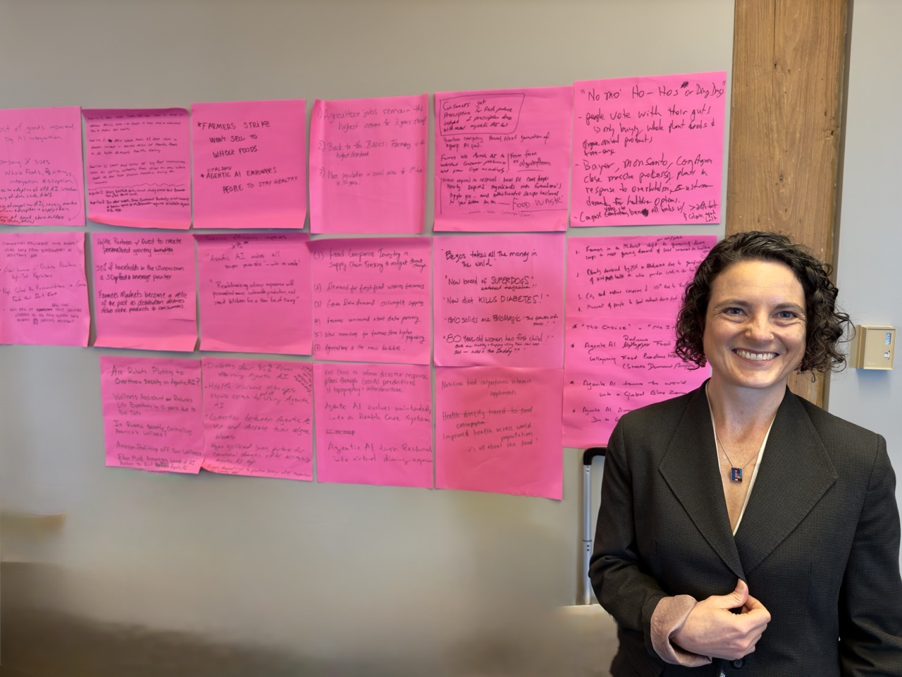
Throughout the day, participants were divided into breakout groups. The morning sessions focused on creative thinking and innovative problem-solving exercises while in the afternoon, the groups used tactics to explore a range of questions the GIFS challenge might address.
Defining the Path Forward: Critical Questions Driving the Challenge

Participants at the inaugural GIFS workshop.
Several questions will guide the participants as they work to identify potential focus areas for the challenge:
- What are the most effective ways geospatial technologies can be used to address food security challenges?
Geospatial technologies are used in wide-ranging applications, e.g. to provide real-time insights into crop health, climate conditions, and soil quality, empowering farmers, policymakers, and organizations to make data-driven decisions. The key challenge is identifying the specific areas where these technologies can have the most significant impact and deliver tangible benefits for global food security. - Which food security problems can be addressed in a meaningful and scalable way?
Participants stressed the need to focus on problems that are not only compelling but also feasible and scalable. The issue is multifaceted, requiring solutions to address both large-scale systemic challenges and localized concerns. The goal is to identify solutions that can be adapted and scaled across different regions for broad, lasting impact. - How can collaboration between geospatial scientists and food security experts drive innovation?
Collaboration emerged as a central theme throughout the workshop. Geospatial scientists offer advanced technical expertise, while food security experts bring valuable field experience. By combining these areas of expertise, the challenge seeks to develop solutions that are both innovative and practically feasible, ensuring they can be effectively implemented in real-world food systems.
Next Steps: A Year of Innovation and Collaboration

Participants at the inaugural workshop.
The first workshop laid the groundwork for a series of collaborative efforts that will continue throughout 2025 and beyond. As the challenge progresses, participants will engage in further workshops, designed to scope the challenge.
“As we continue to develop and refine geospatial solutions, it’s crucial that we stay focused on real-world impact and accelerate the path from research to impact. This challenge is not just about fueling geospatial innovation; it’s about ensuring that our innovations reach those who need them most – the farmers, the communities, and the organizations working on the frontlines of food security,” said Dr. Alameh.
The next major milestone will be the Science Speed-Dating session in February 2025, where participants can exchange ideas and refine proposed focus areas.”
Following that, the “Pitch Day” in April 2025 will give teams the chance to present their argument for a specific problem as the focus of the challenge to a panel of experts.
In May 2025, a Request for Proposals (RFP) will invite teams to propose innovative solutions using geospatial technologies to address key food security challenges. The RFP will be shaped by insights gathered through ongoing workshops and further community consultations. The review and selection of projects will take place in Summer-Fall 2025. Importantly, the RFP is open to any team of researchers and implementing partners, not just those involved in the workshops or the initial consortium.
TGI plans to fund selected projects for 12 to 18 months, with each project team potentially receiving up to $550k in funding to support their efforts in advancing food security through geospatial innovation.
The GIFS Challenge is off to an exciting start. The first workshop revealed the vast potential for geospatial technologies to make a significant impact on food insecurity. Turning these ideas into tangible solutions will require continued collaboration, innovation, and commitment from all involved.
Stay informed and be part of the solution.
Also, keep an eye on this space and our social media channels for the latest updates and opportunities to engage.
About Taylor Geospatial Institute
TGI is passionate about fueling geospatial science and technology to create the next generation of solutions and policies that the whole world will depend on for sustainability and growth.
The TGI consortium includes Saint Louis University, the Donald Danforth Plant Science Center, Harris-Stowe State University, University of Illinois Urbana-Champaign, Missouri University of Science & Technology, University of Missouri-Columbia, University of Missouri-St. Louis, and Washington University in St. Louis. Collectively, these institutions cover geospatial research from ocean depths to outer space.
For more information, visit taylorgeospatial.org.
