In an era defined by data-driven solutions, geospatial technology has emerged as a transformative force—bridging science, policy, and societal well-being. Now, with the advent of generative AI, we stand at the cusp of another significant leap—one that promises to reshape how we understand and interact with our planet.
The Taylor Geospatial Institute (TGI) and Amazon Web Services (AWS) have launched an innovative initiative: the Generative AI for Geospatial Challenge. Formally kicked off on October 29, 2024, in St. Louis, the challenge brought together leading minds in geospatial technology, AI, and cloud computing. With the submission window open until December 6, 2024, participants are invited to transform visionary ideas into actionable projects that could shape the future of geospatial innovation. Offering up to $1 million in AWS credits, along with infrastructure and mentorship, the initiative empowers participants to focus on creativity and problem-solving without being hindered by resource constraints.
“This challenge is about exploring the art of the possible with geospatial data and Generative AI,” said Dr. Nadine Alameh, TGI Executive Director, who, along with Dr. Salem El Nimri, Chief of Space Technology at AWS for Aerospace and Satellite, conceived the idea for the challenge.
Generative AI: The Next Frontier for Geospatial Insights
Generative AI, an advanced form of artificial intelligence capable of creating entirely new ideas and solutions, offers a fresh lens for tackling age-old challenges. Unlike traditional AI, which relies on patterns in existing data, generative AI pushes the envelope by offering predictive, innovative outputs—unlocking insights we didn’t know were possible.
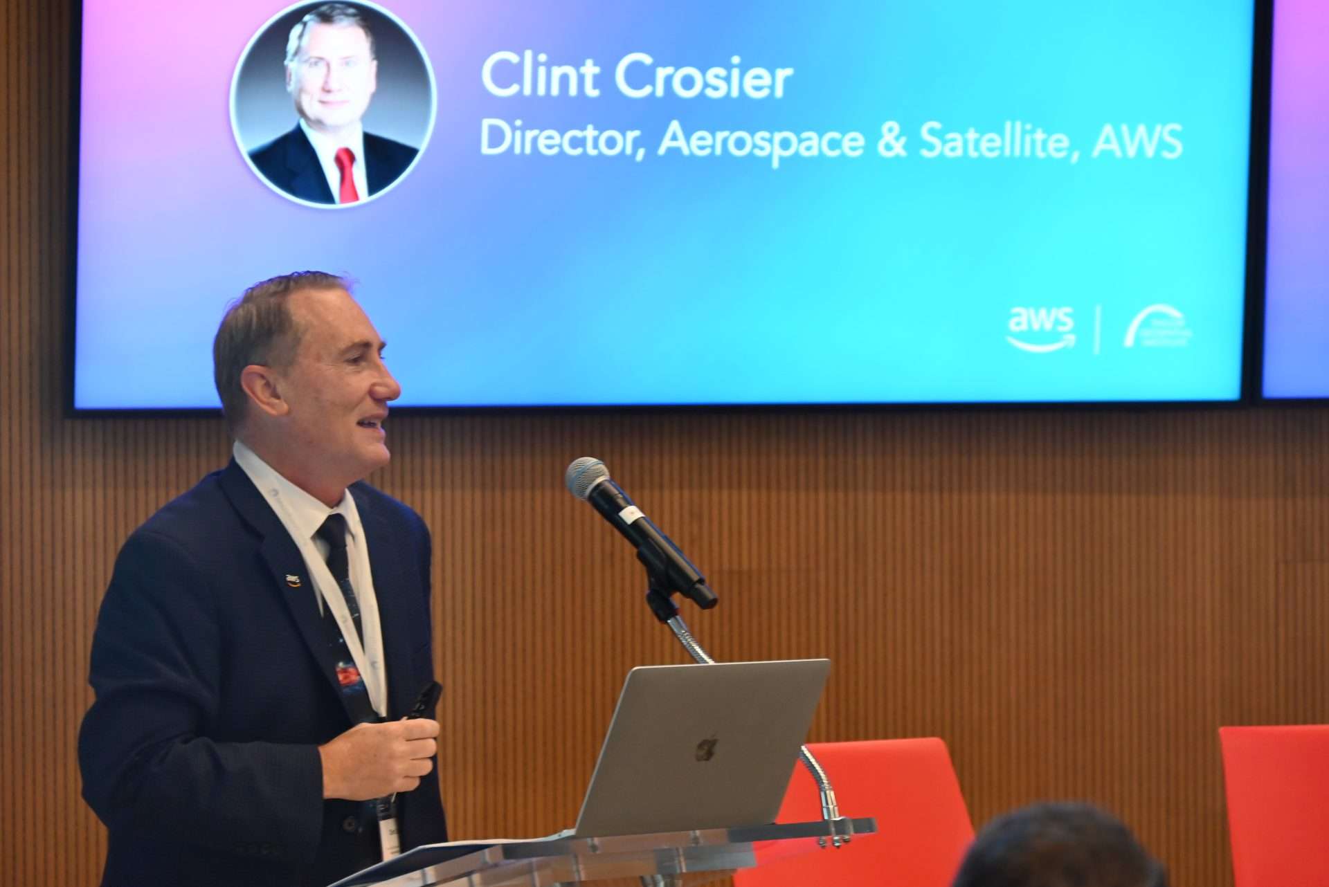
Clint Crosier, AWS’s Director of Aerospace & Satellite Solutions, delivers his keynote
Generative AI builds on traditional AI, taking it to the next level by generating entirely new ideas, concepts, and applications
“Generative AI builds on traditional AI, taking it to the next level by generating entirely new ideas, concepts, and applications,” explained Clint Crosier, AWS’s Director of Aerospace & Satellite Solutions, during his keynote at the October 29 event. This ability to “think” beyond the data makes generative AI a game-changer for geospatial problem-solving.
From urban planning and disaster resilience to climate modeling and biodiversity conservation, the potential applications are vast. For instance, generative AI has been employed to create digital twins of cities like Turin, enabling urban planners to simulate scenarios and assess the environmental impact of green spaces or sustainable building materials.
When asked what Generative AI with geospatial could achieve for societal benefit, workshop participants envisioned a wide range of transformative possibilities. Generative AI would empower not just scientists and engineers but anyone to interact with geospatial data intuitively. It would revolutionize multimodal data integration to enhance decision-making for societal good, enable global-scale digital twins to anticipate and mitigate disasters, and accelerate the analysis of deforestation and natural disasters worldwide – ushering in a new era of impactful geospatial innovation.
Exploring the Boundless Potential of Generative AI
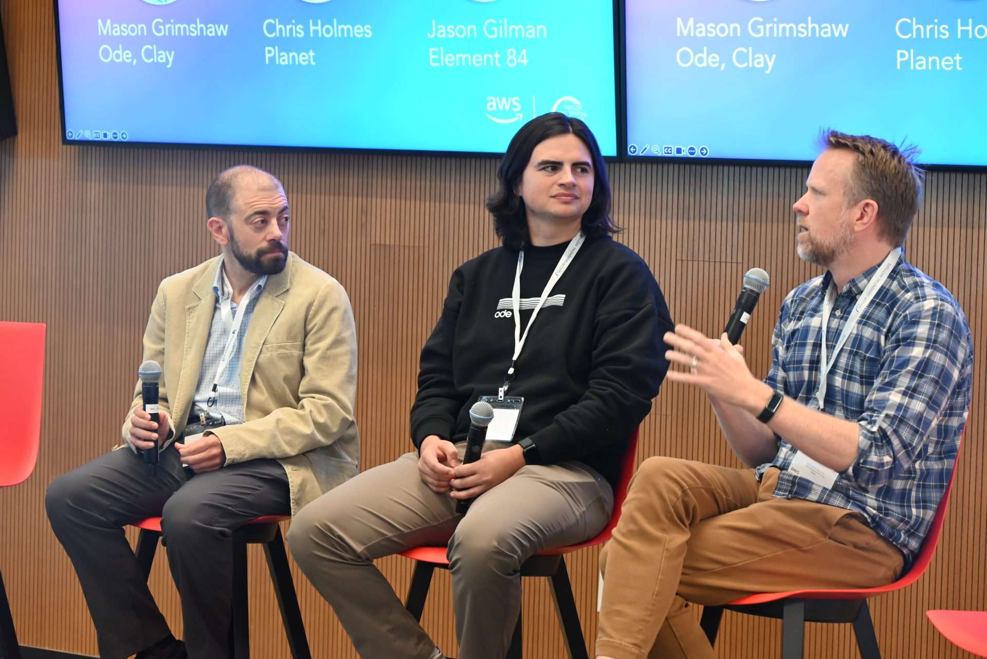
From left: Jason Gilman of Element 84, Mason Grimshaw of Ode Partners/Clay and Chris Holmes of Planet
The October 29 kickoff began with inspiring remarks from Robert Cardillo, Chair of the TGI Governing Council, who emphasized the transformative role of generative AI in addressing critical global challenges. Cardillo also underscored the importance of geospatial data in shaping impactful solutions.
This was followed by thought-provoking talks from leaders in the field, culminating in a dynamic Leaders’ Outlook Q&A session with them.
Chris Holmes of Planet introduced the concept of a “Queryable Earth,” envisioning a future where geospatial data is as accessible and intuitive as a web search. He emphasized the critical need for collaboration across industry, academia, government, and nonprofits to turn this vision into reality. Holmes highlighted initiatives like the Overture Maps Foundation and Fields of the World, which unify data, tools, and standards to drive innovation and advance the geospatial ecosystem.
Holmes also pointed to the challenge posed by the sheer volume of satellite data, which requires advanced AI to extract actionable insights effectively. To address these challenges, he advocated for creating reusable building blocks that simplify geospatial workflows and foster collaboration across sectors.
Mason Grimshaw from Ode Partners described the potential for generative AI to enhance humanitarian missions by enabling faster resource allocation during disasters through the analysis of satellite and ground data in real time. “Imagine AI-generated simulations of disaster scenarios that help governments prepare rather than react,” Grimshaw said. Tools like Clay, often referred to as “AI for Earth,” complement this vision by transforming complex geospatial data into queryable insights, allowing users to ask questions like “Where are all the marinas on the California coastline?” and retrieve precise answers instantly.
Similarly, Jason Gilman from Element 84 highlighted the efficiency gains in operational geospatial workflows, explaining how AI can eliminate time-consuming data preparation steps, streamlining tasks such as flood modeling and evacuation planning. He also advocated for focusing on specific, high-impact use cases rather than attempting to develop overly broad or generalized systems, as a foundation for effectively applying generative AI. “We need to focus on the user and the problems they need addressed,” he emphasized.
We need to focus on the user and the problems they need addressed
Additionally, Gilman emphasized the potential for generative AI to democratize geospatial tools, enabling non-experts to perform complex spatial analysis through natural language interfaces.
The “ChatGPT of Earth” Vision
One of the most compelling ideas for generative AI emerging from the challenge is the concept now being referred to as the “ChatGPT of Earth.” This vision imagines a semantic search application that makes complex geospatial insights accessible to everyone, regardless of their technical expertise.
TGI_2514
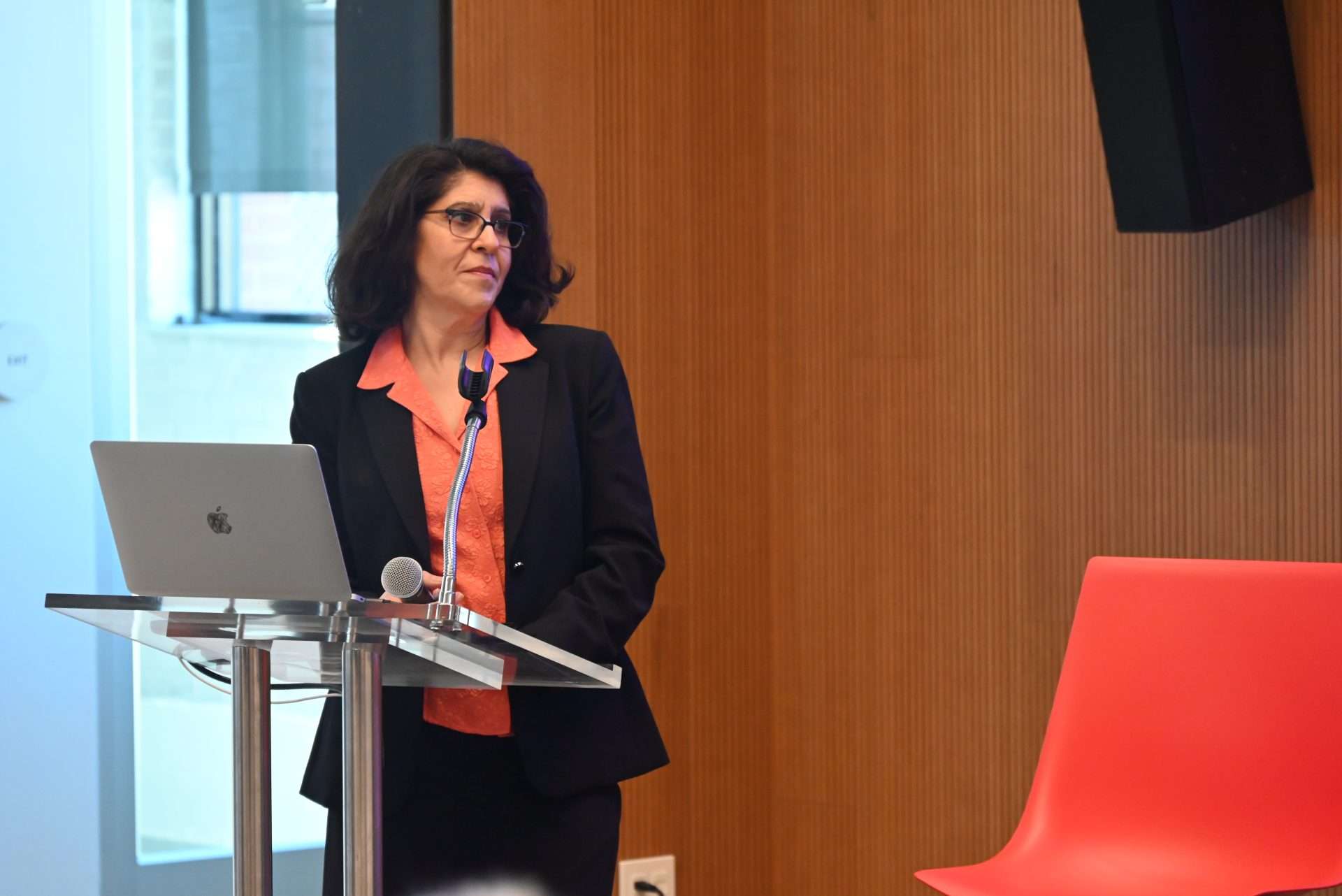
“Wouldn’t it be amazing if we could simplify geospatial analysis to the point where anyone could ask a question and receive meaningful, intuitive answers?” Alameh asked, highlighting generative AI’s potential to bridge the gap between complex geospatial data and real-world applications. Similar to how ChatGPT processes natural language queries, this vision involves creating an intuitive interface for accessing and understanding geospatial insights.
“It’s going to take all of us collaborating to build the ‘ChatGPT of Earth’– bringing together building blocks, models, semantics, infrastructures, and metrics,” she added, emphasizing the collective effort needed to realize this transformative vision.
It’s going to take all of us collaborating to build the ‘ChatGPT of Earth’– bringing together building blocks, models, semantics, infrastructures, and metrics
This vision ties closely with practical applications, such as conversational interfaces that could transform access to space and Earth data. These ideas collectively point to a future where geospatial technology is intuitive and widely usable, democratizing access to critical data for decision-making. Whether it’s a city planner exploring urban growth scenarios or a farmer seeking real-time crop insights, the “ChatGPT of Earth” could serve as a universal tool for informed decision-making.
The Generative AI for Geospatial Challenge
The Generative AI for Geospatial Challenge invites innovators to propose bold solutions that fuse generative AI with geospatial insights. Participants are encouraged to push boundaries and envision transformative possibilities.
Proposals will be judged on their novelty, scalability, and societal impact. Projects must integrate geospatial data in meaningful ways, reflecting the field’s core mission to connect the dots between location, time, and context.
- Period: The submission period for proposals began on October 29, 2024, and concludes at 11:59 p.m. CT on December 6, 2024.
- Awards: Selected proposals will share up to $1 million in AWS credits. Winners will be announced in mid-December 2024. Researchers from TGI consortium institutions may also receive additional financial support at TGI’s discretion.
Highlights of Contributions from the Kickoff Event
The October 29 kickoff event in St. Louis served as a melting pot of ideas, with leaders from across sectors sharing their expertise and vision. In addition to keynote speeches by Crosier and Alameh, and the leader’s outlook from Holmes, Grimshaw, and Gilman, the event featured two engaging panel discussions:
Insights & Predictions on Geospatial Generative AI in Government
- Peter Doucette, USGS EROS – Highlighted the potential of AI to enhance the analysis and management of vast Earth Observation datasets, with a focus on advancing multimodal data integration.
- Hook Hua, NASA JPL – Emphasized democratizing geospatial AI by breaking down challenges into manageable segments, enabling scalable and efficient solutions accessible to a wider audience.
- David Page, Oak Ridge National Laboratory – Stressed the importance of targeted geospatial AI applications for societal and environmental benefits, with a focus on solving high-impact challenges such as landslide detection, flood modeling, urban planning, and renewable energy optimization.
- Shaliya Dehipawala, Scale AI – Shared insights on the role of automated data labeling and training in accelerating geospatial model development.
The Future of Geospatial Generative AI through the Lens of Industry & Research
- Hamed Alemohammad, Clark University – Advocated for collaborative research to fine-tune AI models for specific geospatial applications and improve their interpretability.
- Gregory Brunner, Esri – Focused on the integration of generative AI into mapping and artificial intelligence workflows.
- Steven Ward, Deloitte – Discussed how generative AI can aid in analyzing vast datasets, streamlining the reporting process, and improving the verification of climate and sustainability-related metrics for audits.
- Martice Nicks III, Danti.ai – Showcased tools aimed at improving food security through AI-driven agricultural insights.
The contributions from the participants collectively highlight the interdisciplinary and collaborative nature of the challenge, which aims to bridge gaps between academia, industry, and government.
Building on the ideas presented during the event, the experts discussed the broader path forward for geospatial including :
- Starting with Users: Focus on understanding the users’ needs and the problems that need solving, rather than beginning with the technology or data.
- Developing reusable toolsets to support ecosystems of data, software, and models, enabling efficient workflows and reducing duplication of effort.
- Establishing metrics and benchmarks to evaluate various approaches, ensuring trust and consistency in geospatial applications through robust comparisons of object measurements and model outputs.
- Creating modular architectures and pluggable building blocks to seamlessly connect large language models (LLMs) with geospatial datasets, enhancing usability and accessibility.
- Expanding infrastructure for geospatial machine learning with robust platforms such as Planet Insights, Google Earth Engine, and Microsoft’s Planetary Computer to process and analyze vast datasets effectively.
“Together, we’re making history—turning the potential of generative AI into impactful solutions,” Crosier aptly remarked in his keynote. Echoing this optimism, Alameh urged participants to think boldly and collaborate widely: “Through this initiative, TGI is excited to be fueling innovation and impact with collaboration at scale.”
About Taylor Geospatial Institute
TGI is passionate about fueling geospatial science and technology to create the next generation of solutions and policies that the whole world will depend on for sustainability and growth.
The TGI consortium includes Saint Louis University, the Donald Danforth Plant Science Center, Harris-Stowe State University, University of Illinois Urbana-Champaign, Missouri University of Science & Technology, University of Missouri-Columbia, University of Missouri-St. Louis, and Washington University in St. Louis. Collectively, these institutions cover geospatial research from ocean depths to outer space.
For more information, visit taylorgeospatial.org.

