Artificial Intelligence (AI) is no longer on the horizon for geospatial technology – it’s here, transforming how industries operate. From urban planning to disaster response, AI is making geospatial data faster to process, easier to analyze, and more actionable than ever before.
The transformative potential of AI was at the heart of the TGI GeoAI Working Group meeting, held online on February 6, 2025, where experts gathered to explore how Generative AI is reshaping the way we process, analyze, and apply geospatial data. The conversation wasn’t just about research — it focused on real-world applications, accelerating innovation, and turning complex data into solutions that matter.
But innovation doesn’t happen in isolation. It thrives when fresh ideas from emerging innovators, industry leaders, and researchers come together to solve complex challenges.
That spirit of collaboration is exactly why TGI and AWS launched the Generative AI for Geospatial Challenge – to spark bold, new approaches to AI-powered geospatial intelligence. By creating a platform for knowledge-sharing and partnership, TGI is helping to fuel innovation, accelerate the path to commercialization, and ensure that advancements in AI aren’t just theoretical but actively contributing to a better, more resilient world.
AI Is Reshaping the Geospatial Industry
For decades, geospatial professionals worked with massive datasets, complex satellite imagery, and time-intensive processing methods. But with AI, those barriers are fading fast.
Phil Cooper, AWS Global Business Development for Geospatial, reflected on just how far the industry has come. “Not long ago, researchers spent entire PhD programs analyzing a single satellite image. Today, we process petabytes of geospatial data in real time. The scale of what we can do now is unprecedented.”
While the sheer volume of geospatial data presents challenges, it also creates extraordinary opportunities – especially for innovative companies like the winners of the TGI AWS Generative AI for Geospatial Challenge.
At the February 6 meeting, LuxCarta and Danti, two of the challenge winners, presented their groundbreaking innovations in AI-driven mapping and disaster response, where Cooper pointed out “We are only seeing a tiny percentage of what people can do with geospatial AI. The real breakthroughs are still ahead of us.”
AI-Powered 3D Mapping: LuxCarta’s Vision

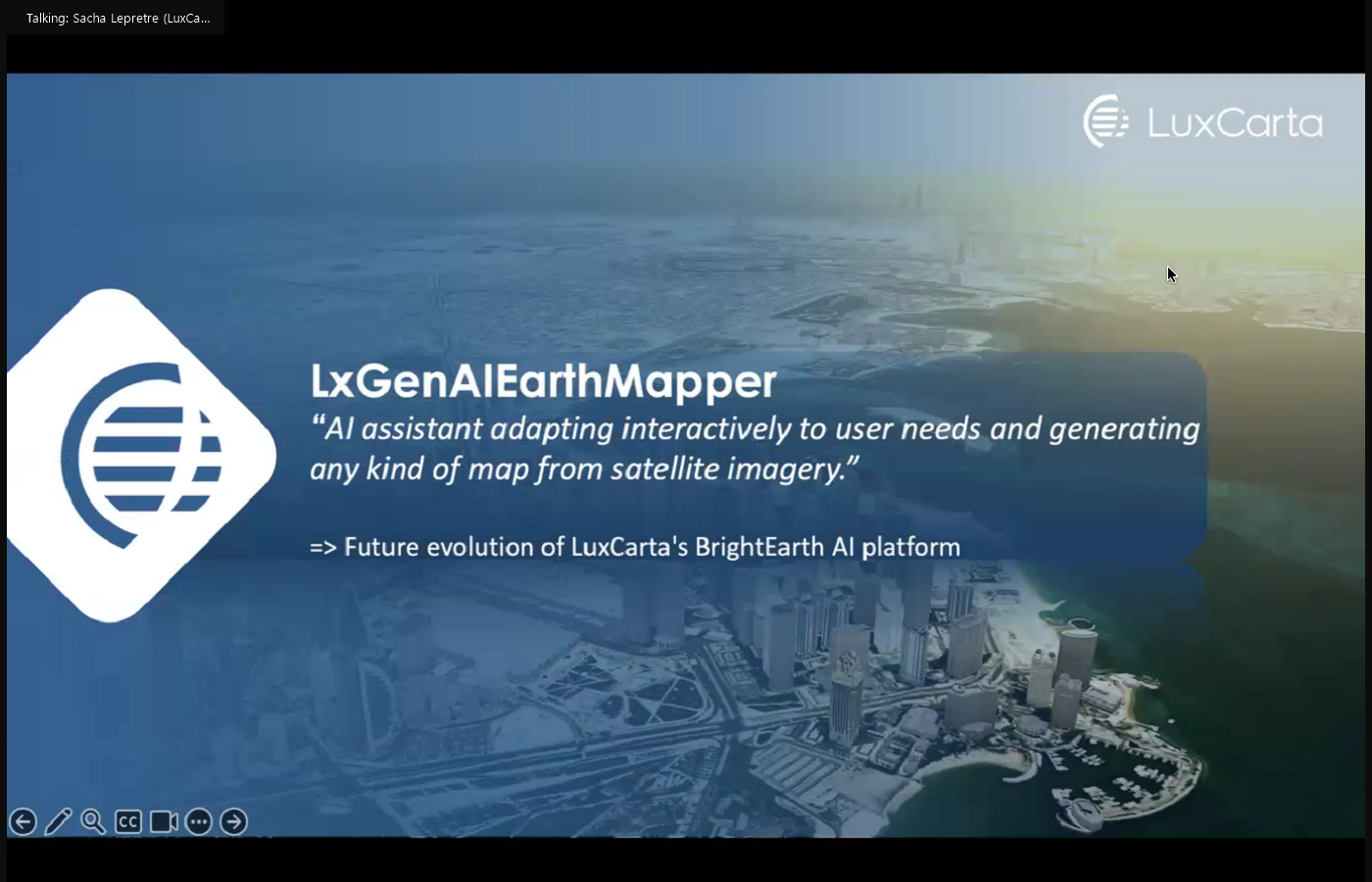
Creating accurate, up-to-date maps has always been a challenge, but LuxCarta is using AI to completely transform the process. Instead of manually processing satellite images, their AI-powered platform generates high-resolution, 3D interactive maps in a fraction of the time.
Sacha Lepretre, CTO of LuxCarta, described how their GenAI Earth Mapper automatically extracts key features – roads, building footprints, vegetation, and more – to create detailed, customizable geospatial datasets. “AI enables us to generate maps faster and with greater accuracy, but we ensure a human-in-the-loop approach to refine results and improve decision-making.”
The technology has applications in urban planning, telecom, and disaster management, providing decision-makers with the latest, high-quality geospatial data when needed.
Danti: AI for Disaster Response & Decision-Making

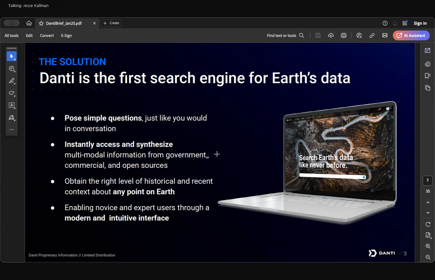
When disasters strike, getting the correct information quickly can mean the difference between life and death. Yet, many emergency response teams still struggle with delayed reports, fragmented data sources, and slow decision-making processes. This is a problem Danti is tackling with its multimodal AI system, designed to process satellite imagery, news, social media, and sensor data in real time.
Jesse Kallman, CEO of Danti, explained that the biggest challenge today isn’t just collecting data, but making sense of it quickly. “There’s an explosion of geospatial data, but not enough analysts to process it all. AI helps bridge that gap, ensuring faster, smarter decision-making in critical situations.”
By integrating AI-powered analytics, Danti helps governments and agencies rapidly assess disaster impact, ensuring they can file disaster declarations faster, secure federal funding sooner, and mobilize emergency resources effectively. Kallman noted that in the past, teams spent hours compiling reports before decisions could be made. Now, AI enables them to generate a full situational assessment in seconds. This not only saves time but ensures that responders have the most relevant and up-to-date information available.
The Generative AI for Geospatial Challenge: A Catalyst for Innovation
The projects showcased by LuxCarta and Danti at the TGI GeoAI Working Group meeting — from cutting-edge 3D mapping to real-time disaster response tools — are just a glimpse of what’s possible when AI and geospatial technology converge.
The TGI AWS Generative AI for Geospatial Challenge was designed to accelerate this kind of innovation – by bringing together emerging innovators, established industry leaders, and researchers to push the boundaries of what geospatial AI can achieve. Since its launch in October 2024, the challenge has attracted 55 proposals from innovators across five continents, with $1 million in AWS credits awarded to projects poised to reshape the industry.
But for TGI, it’s about more than just funding – it’s about building a global community of geospatial innovators who can collaborate, share knowledge, and turn groundbreaking ideas into real-world solutions. As AI continues to evolve, these partnerships will be critical in ensuring that new technologies not only reach the market faster but also make a meaningful impact.
With new AI-driven tools, deeper collaborations, and growing investments in geospatial intelligence, one thing is clear: the future of AI in geospatial technology isn’t just coming – it’s already here.
Want to be part of the conversation?
Join the next TGI GeoAI Working Group meeting in March and help shape the future of geospatial AI. Register here
About Taylor Geospatial Institute
TGI is passionate about fueling geospatial science and technology to create the next generation of solutions and policies that the whole world will depend on for sustainability and growth.
The TGI consortium includes Saint Louis University, the Donald Danforth Plant Science Center, Harris-Stowe State University, University of Illinois Urbana-Champaign, Missouri University of Science & Technology, University of Missouri-Columbia, University of Missouri-St. Louis, and Washington University in St. Louis. Collectively, these institutions cover geospatial research from ocean depths to outer space.
For more information, visit taylorgeospatial.org.
